CURRICULUM: 2


 STEP 2 – Bridging Approach: Fencepost Activity
Students represent personal data, thoughts, and opinions in a graphic form and observe and discuss gathered responses.
Instructions (downloadable pdf)
Design Tools Guide
Fenceposts Template
Student Activity Sheet
Here is a short overview of Part 2 – the Fencepost Activity (9:38). It reviews the Design Tools handout and survey questions and discussion portions of the fencepost activity and provides an example related to hurricanes.
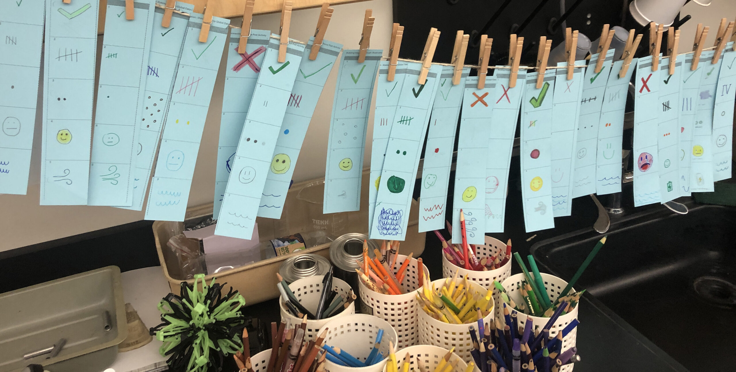
This activity asks students to respond personally to a series of environmental, science, and data related questions and then compare and discuss responses. The goal is to harness the power of individuals to illustrate connections within a classroom, as well as to broader communities and systems. Students respond to a questionnaire creatively through collage, drawing, designing, writing, and coloring. The end results are collaged together into a classroom piece and used as a focus of discussion of connections and observations. The activity can be adapted or modified to suit the needs of your classroom and the resources that are available. This example is for severe weather, hurricanes.
- Give each student the Design Tools Guide handout
- Provide context about data collection/sources and symbology.
Suggested text:“Data like we just saw in the Science on a Sphere exercise comes from a variety of sources – individuals can collect data at a local level or one point in time and then combine those observations/data to show data over time or over a larger spatial area. We can also collect data with satellites which provide large areas of remotely sensed observations and can even provide global pictures of data/science phenomena. People use symbols to convey information in a simple and effective way. Symbols are an important part of maps and can represent a range of different types of data. Symbols are described in a legend – a box or other place on the map where there is a key that says what each color of symbol means. Let’s look at different ways we can represent data.”
- Review the Design Tools Guide – you can ask the students to reflect on the previous activity comparing maps about which design tools were used/chosen and why.
- Give each student a strip of paper that is divided into 5 squares numbered 1 through 5. Hand out the survey questions. Want some help with the questions? See the Teacher Guide for Writing Survey Questions. We’ve also compiled an Idea Bank of Questions for you to use.
- Read through each question and discuss with the class what symbol they think would be best for each answer choice (this could also be done initially in pairs and then discussed/decided on as a whole class).
- Have the students answer the questions on their strip using the colors/symbols that correspond to their answer choice. Instruct the students to work their way through the questionnaire and respond to the first question in the first block and so on. For some questions, students can color, draw or collage with images from the magazines. For other questions, a written word or phrase is ideal.
- After all students have finished their responses, line all the students’ work side by side as a “fence post” (tape them on a wall or attach to a string) so that you can see trends across the class. Explore the results with the class.