CURRICULUM


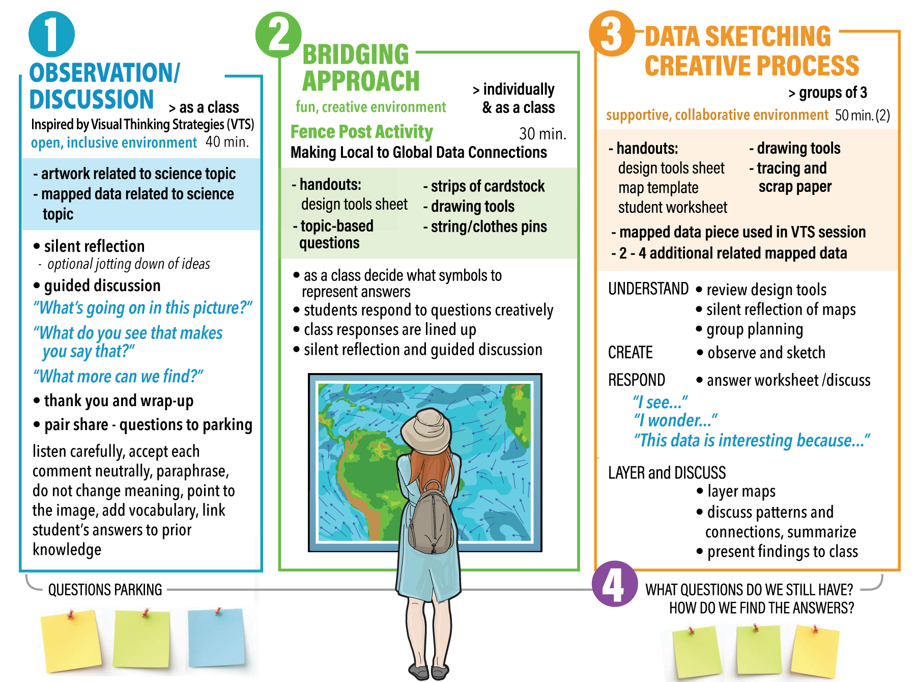
The Building Insights through Observation (BIO) model consists of four parts: 1) Observation and Discussion; 2) Bridging 3) Data Sketching, and 4) Discussion and Questions. The approach can be adapted to a range of content areas. The teacher selects a single topic area (e.g., plate tectonics) and then finds related art work and global mapped data.
Please read through each step below to learn more about this process. A printable, full lesson template can be found here. The template can be used to help you build your own curriculum. Sample curricula can be found in the Resources section.
![]() Observation and Discussion:
Observation and Discussion:
Art/Data
“VTS-inspired” observation sessions of at least two images – an art piece relating to the topic of the unit, and a related geospatial data visualization.
![]() Bridging Approach:
Bridging Approach:
Fence Post Activity
Students represent personal data, thoughts, and opinions in a graphic form and observe and discuss gathered responses.
Go to Step 2.
Go to Step 3.![]() Data Sketches
Data Sketches
Using a creative thinking process, students create their own representations of geospatial datasets on tracing paper, then overlay those different “data layers” to discuss patterns and correlations.
![]() Guided Discussion
Guided Discussion
Students review questions that arose during the first three steps and discuss where they might find the answers to those questions.
Finish with Step 4.
Note: Although the time required varied among the teachers who developed and implemented their units for the project, the full unit typically required at least 3-4 class periods of at least 45 minutes each.